Coastal Living in 2026: The Ultimate Dana Point Orange County CA Area Guide
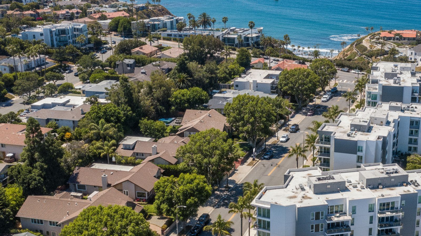
Situated along the southern coast of California, Dana Point offers a distinct blend of dramatic oceanfront cliffs and accessible harbor amenities. Buyers looking at the coastal market in 2026 will find a city undergoing significant modernization while retaining its classic surf culture roots.
Navigating the local real estate landscape requires an understanding of specific neighborhood nuances, from gated luxury enclaves to walkable commercial districts. This guide breaks down current market data, infrastructure updates, and the logistical details necessary for making an informed property investment in the area.
Dana Point Housing Market and Real Estate Trends
The residential real estate landscape in Dana Point reflects its premium coastal positioning, with median home prices hovering around $2,400,000 as of the spring of 2026. Property values vary sharply depending on proximity to the water and specific neighborhood boundaries. A home located on the ocean side of California State Route 1 will command a significant premium compared to properties further inland.
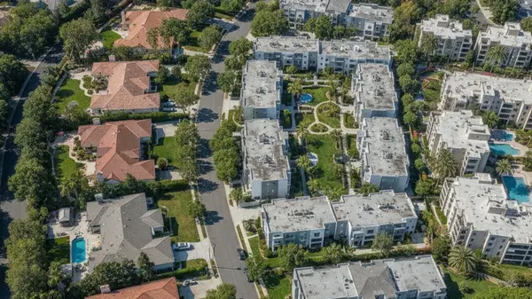
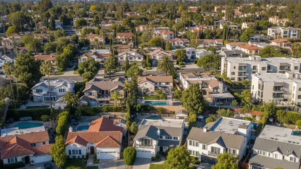
Buyers will find a diverse mix of property types across the city. The inventory ranges from luxury oceanfront estates in gated communities like Monarch Bay to mid-century single-family homes and modern coastal condos in the Lantern District. Navigating these options requires a clear understanding of the associated carrying costs, particularly regarding local property taxes.
Under Proposition 13, the base property tax rate in CA is set at 1% of the assessed value. However, the effective tax rate in Dana Point typically ranges between 1.01% and 1.20% before accounting for specific Mello-Roos fees. Buyers exploring newer developments or specific master-planned communities should budget for these additional assessments and varying HOA fee structures.
The clear takeaway for buyers is to scrutinize the monthly carrying costs of HOA dues and special assessments just as closely as the base purchase price.
Local Amenities, Beaches, and Harbor Revitalization
The commercial landscape of Dana Point is currently defined by the massive $600 million revitalization of the Dana Point Harbor. Phase 3 of this project, which forms the commercial core, is actively under construction and targeting a late 2026 completion. This development will introduce approximately 100,000 square feet of new waterfront retail, restaurants, and public green spaces to Mariner's Village.
Beyond the harbor, the walkable Lantern District serves as the primary commercial hub for local dining and boutique shopping. Residents enjoy easy access to a variety of restaurants, cafes, and specialty shops situated along the main thoroughfares. For those interested in resort-style amenities, the Monarch Beach Golf Links offers a premier 18-hole course with sweeping views of the Pacific Ocean.
The transformation of the harbor area represents a major shift for the city's infrastructure. Buyers evaluating properties near the water should factor the upgraded amenities into their long-term property value assessments.
Parks and Coastal Recreation
Outdoor recreation is a central component of the Dana Point lifestyle, anchored by extensive public beach access. Doheny State Beach and Salt Creek Beach Park provide expansive stretches of sand, well-maintained facilities, and consistent surf breaks. These locations serve as primary gathering points for surfing, paddleboarding, and coastal relaxation throughout the year.
For hiking and scenic walking, the Dana Point Headlands and the Bluff Top Trail offer elevated, panoramic views of the coastline. The city is also widely recognized as the Whale Capital of the West due to its rich marine life. Year-round whale watching excursions launch daily from the harbor, offering residents direct access to one of the most active marine migration routes in CA.
Capistrano Unified School District and Local Education
Public education in Dana Point operates under the jurisdiction of the Capistrano Unified School District. This large district serves multiple cities in southern Orange County and manages the public school assignments for Dana Point residents. Dana Hills High School is the primary public high school located directly within the city limits.
School assignments are dictated by highly specific, street-level boundaries rather than general zip codes. Prospective buyers should always verify their exact school track using the official address locator tool provided by the Capistrano Unified School District. Relying on third-party real estate portals for school data can lead to inaccurate assumptions about enrollment eligibility.
In addition to the public school system, the surrounding region offers numerous private educational facilities. Buyers looking for specialized academic programs or alternative educational models will find several established private campuses within a short driving distance in neighboring communities.
The critical takeaway for buyers prioritizing education is to verify enrollment boundaries before submitting an offer, as a property situated just one block over can result in a completely different school assignment.
Commuting, Transportation, and Highway Access
Dana Point offers straightforward logistical access to major regional employment hubs through two primary corridors. Interstate 5 runs along the eastern edge of the city, while California State Route 1 - commonly known as the Pacific Coast Highway - cuts directly through the coastal sections. These routes form the backbone of daily commuting for local residents.
Commute times vary significantly depending on the destination and the time of day. Traveling to the commercial centers in Irvine covers approximately 22 miles and averages a 30-minute drive under standard conditions. Heading south to San Clemente is a much shorter trip of about 6 miles, typically taking 10 to 15 minutes by car.
Public transportation options are available for those who prefer to avoid driving. The Orange County Transportation Authority manages several local bus routes that connect Dana Point to surrounding municipalities. Additionally, commuters have convenient access to regional train stations in nearby San Juan Capistrano and San Clemente, which provide direct rail service to Los Angeles and San Diego.
Buyers should physically test their anticipated commute during peak rush hour, as traffic patterns on Interstate 5 can drastically alter the baseline drive times.
Frequently Asked Questions
What coastal hazards should I research before buying in Dana Point?
Buyers evaluating coastal real estate should conduct thorough due diligence on bluff setbacks, coastal erosion rates, and sea-level rise assessments. Geologic hazard reports are essential for properties located near the cliffs or directly on the sand. Reviewing these specific environmental disclosures can prevent unexpected structural or regulatory issues down the line.
How will Dana Point Harbor construction affect living in the Lantern District?
The ongoing 2026 harbor revitalization will bring temporary logistical impacts, including increased construction traffic and adjusted parking configurations near the water. However, the Lantern District sits elevated above the harbor, shielding most residential streets from direct construction noise. Buyers should anticipate minor delays on the primary access roads heading down to the marina until the project concludes in late 2026.
Do I need special insurance for a bluff or oceanfront home in Dana Point?
Properties located in designated FEMA flood zones or perched on coastal bluffs often require specialized insurance policies. Standard homeowner policies typically exclude flood damage, earth movement, and specific coastal hazards. Buyers should request preliminary insurance quotes during the escrow period to accurately project their monthly carrying costs for a waterfront home.
Categories
Recent Posts